


The uncertain economic climate brought about by the global pandemic has led to some land and asset based projects such as railways and utilities being fast-tracked. But teams would be well advised not to disregard project stakeholders in their efforts to speed up project delivery.
COVID-19 has not changed the rules of engagement. Failing to adequately manage social risks can still lead to project delays, cost overruns, and even work stoppages. Adopting effective stakeholder management tools and methods is a much surer way to shorten the path to social acceptance.
Is your approach to managing assets and stakeholders reactive and prone to oversights?
When it comes to linking land and asset management to stakeholder acceptance, it’s vital that the right people are informed at the right time and with the right message. While this may seem easy enough, oversights and errors are common even in small-scale, short-term projects involving few assets and stakeholders. This is often due to the fact that information is not centralized or readily accessible. In projects involving many stakeholders, oversights and errors become even more common and problematic.
The bigger the scale and stakes of a project, the more important it is to use the right tool to manage stakeholders and assets. Many teams around the world use the Land Access and Management module in Borealis stakeholder engagement software to ensure their asset-based projects stay on time and on budget with minimal bumps along the road to stakeholder acceptance.
The Land Access and Management module includes a number of features that asset management teams rely heavily on to streamline activities. Here are the 5 main features:
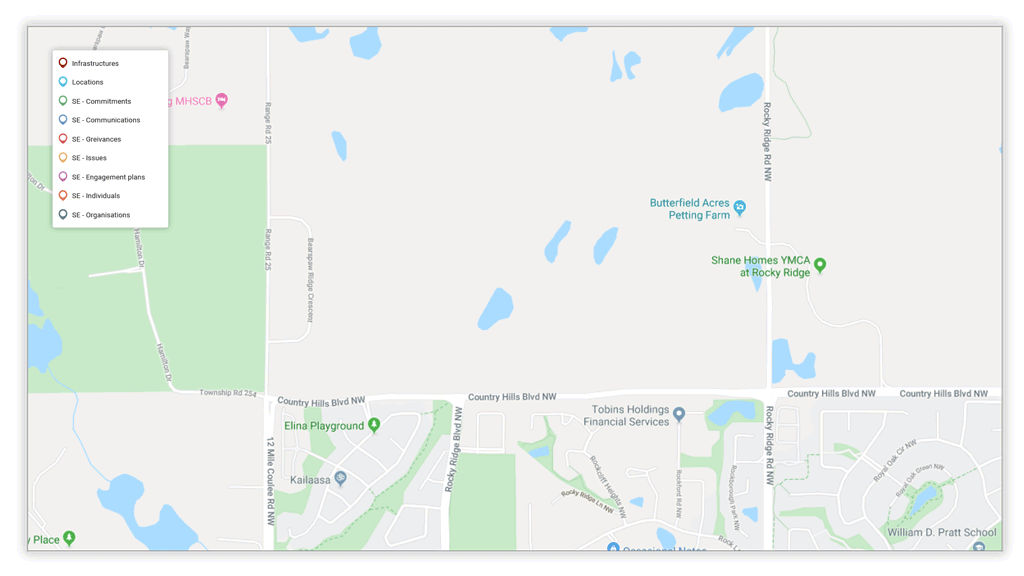
1. GIS technology for forecasting proposed routes
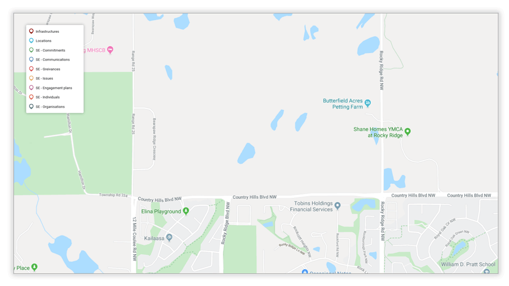
There are many factors to consider when planning a new route for an infrastructure project. But the engineering team won’t necessarily be in a position to evaluate the social risks of a given route. The geographic information system (GIS) in Borealis software can be used to determine which route might be “easiest” for securing social acceptance.
The GIS function in Borealis can be used to map proposed options alongside existing infrastructure to evaluate various scenarios, such as:
- How many parcels the proposed route will pass through
- How much overlap there is
- How many stakeholders lie along the proposed route
- Who these stakeholders are and what type of relationship you have with them
With this information, you can drill-down into your project stakeholder records in Borealis to see:
- Details of past discussions with these stakeholders
- What their concerns are, what their level of influence/support for the project might be
- How this relationship has changed over time
Mapping proposed routes will also help to identify any existing or potential future hotspots, resulting in better decision making and foresight of potential issues.
- See issues, grievances, and communications at a glance
- Ensure you’re communicating with the right stakeholders
- Link stakeholders to various assets
- Import or create shape files
Buffer zones can also be added to maps to include all potentially affected stakeholders within a certain distance from a proposed route, such as within a 1-km radius. This will tell you how many stakeholders you will need to talk to for a given route.
- Determine a zone around your asset
- Know which parcel owners you need to engage with
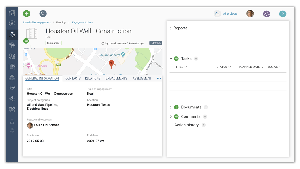
2. Comprehensive engagement plans for more targeted efforts
Creating engagement plans in Borealis will organize all this information to give you a global view of the project from different perspectives. Rather than working with a simple list of stakeholders, you will be able to see them on the map and dig deeper with just a click. No need to weed through emails or spreadsheets to find the answers you need now.

See how one Canadian utility company uses Borealis to access all communications with stakeholders associated mapped assets.
3. Centralized information platform for breaking down silos
Information is only useful if you can access it when you need it, and in a form that’s meaningful to you:
- Your Land team may be diligently entering data into the GIS, but is this information being shared freely with the Environmental Approval team?
- Once land agreements have been discussed and finalized, is this information being passed on to the Construction team?
- Is all this information instantly accessible during public hearings to answer questions intelligently and accurately about who did all that door knocking to engage with project stakeholders – and when?
Integrating your land and asset management in the Borealis platform keeps all this information readily available to anyone who needs it at a moment’s notice.
Borealis facilitates information management and sharing by providing an intuitive and easy-to-use centralized platform that allows users to easily retrieve interactions from various sources, including informal conversations (phone, in person, WhatsApp), emails/calendar invites, social media feed, and other sources.
When the information “groundwork” is well managed, team members can spend more time on identifying issues, analyzing strategies and pursuing other value-added initiatives, rather than on low-value tasks such as data entry, sharing or cleaning up Excel files, etc.
See how Borealis software helps organizations break down silos.
4. Mobile App for easy access to information in the field
Having easy access to information when visiting the field is priceless. The Borealis mobile App allows users to access and enter stakeholder information from any location via their mobile device; they don’t need to wait to be back in the office to get the answers they need now.
With the App, you can always see:
- The profile of the stakeholder you’re about to speak with
- What conversations have already taken place with this stakeholder
- What the stakeholder thinks about your project before you meet with him or her
This information will help you avoid being blindsided and answer stakeholder questions right then and there, a great way to build trust. You can also use the app to input information immediately after meeting with a stakeholder while the details are still fresh in your mind, resulting in more complete and accurate records.
Users in the field looking for even more detailed stakeholder information, such as “whose land am I currently on?” can log into the Borealis platform for full system functionalities. They simply need an internet connection.
5. Visually compelling reports to communicate compliance
Borealis makes it easy to prove compliance with sharp and visually compelling reports that make it easy for regulators, lenders, municipal governments, and other authorities to read and understand key project details:
- Number and categories of stakeholders you have met with
- Number and types of issues
- How you addressed these issues
- And much more.
Instead of simply presenting lists, you can provide this information according to land parcels on a map, all while keeping confidential stakeholder information private.
This proactive transparency can become a convincing pitch for your project. When this transparency is supported with diligent record-keeping and an ability to answer questions intelligently in a timely manner, it can also create goodwill with those who hold the fate of your project in their hands.
- Easily extract information and present visual reports showing details of your stakeholder and community relations activities to:
- Show upper management the value your team is creating for the organization
- Demonstrate your due diligence to government agencies and industry regulators
- Prove compliance with industry regulations
- Improve your strategies based on emerging hot spots requiring increased attention
- Track stakeholder sentiments and trends in real time
- Adapt strategies and messaging as the stakeholder landscape evolves over time
See how the Land Access and Management module in Borealis can help you create more value for your organization.
Compensation management
Failing to properly manage land access and assets can quickly drain resources and expose a project to potential failure. The Land Access and Management module in Borealis will help you better identify and manage risks so that you can improve resource allocation and avoid unnecessary project disruptions.
See how the Borealis team work with you from day-one to ensure user adoption and a smooth transition.
And if you ever you want to add the compensation component to your land and asset management, the Land Access and Management module will facilitate payments to landowners.