

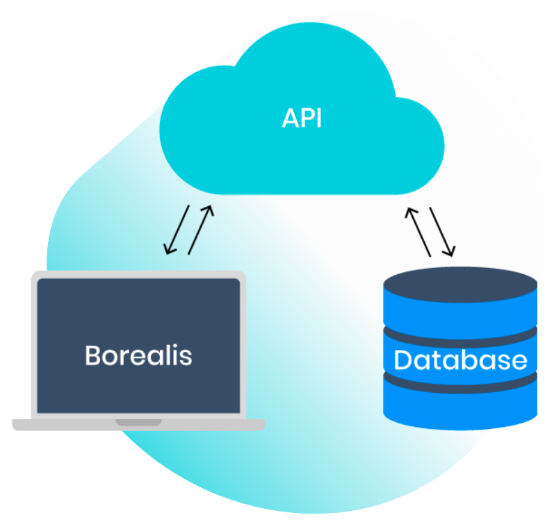
BOREALIS API
Save time by working
more efficiently
Put all of your applications to work for stakeholder engagement! With the API, you can connect Borealis to your GIS, CRM, SAP, and endless other tools to be sure you’re always working with complete data. Easily import and export data and entries will update automatically across systems – a real game changer when data needs to be frequently added or updated, or when data collected from an external source changes in real time.
Minimizes tedious manual data manipulation and
shows you the bigger picture with Borealis’ API
Social media platforms
CRMS
Create a new entry in your CRM and push it automatically to Borealis. Any fields that are added or updated in the CRM will be automatically updated in Borealis accordingly. You can also set it up the other way and push new stakeholders from Borealis into your CRM.
GIS database
Content Management System
Easy self-service, with support available if you need it
Our API documentation makes self-service integration easy. If needed, we can help your team:
- analyze and identify optimal integration processes;
- make minor adjustments to API endpoints to simplify
your integration; - develop automated tests;
- create a Widget that will provide a clear view of the information that needs to be transferred by the API.
Borealis API allows the integration of different application
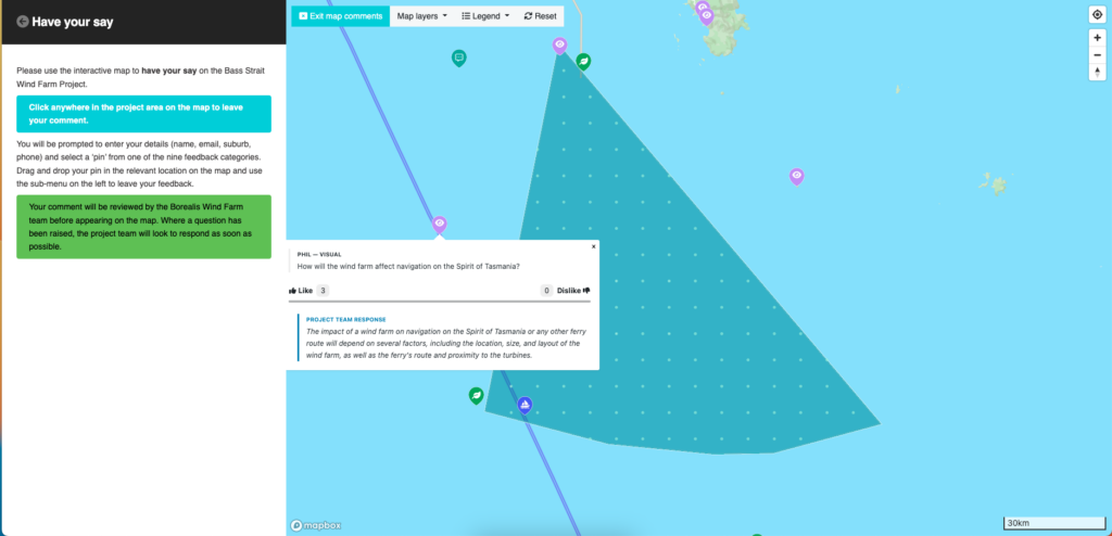
Community Analytics from Spatial Media offers interactive tools for communication and public participation
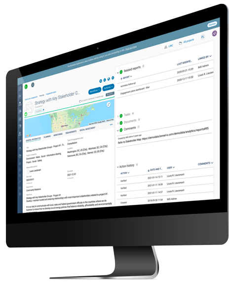
The Borealis API feature can be used to integrate data to any of our modules
The Borealis Stakeholder Engagement Core Module can be complemented with various other modules that will help you teams simplify and standardize their processes in order to build trust with stakeholders, improve engagement outcomes, and strengthen all areas of environment, social and governance.

Contact us
Improve stakeholder engagement strategy with more effective planning, engagement and monitoring. Find out how Borealis stakeholder engagement software can help.