

MANAGING STAKEHOLDER ENGAGEMENT FOR LINEAR ASSET INTEGRITY PROJECTS
Before any sort of maintenance activity, teams need to contact different groups of stakeholders for a number of reasons. They might need to:
- negotiate right-of-way (ROW) agreements
- document landowners’ conditions for accessing land
- inform occupants about upcoming work and provide safety information
- ensure compliance with applicable laws
- secure regulatory approvals and acquire necessary permits
- arrange any necessary inspections
- coordinate with external suppliers and contractors
- document issues, concerns, or complaints
When data is stored in different places and populated by different teams, it can be incredibly difficult to compile the information you need. And when processes aren’t integrated between different sites or departments, it can become burdensome – if not virtually impossible – to see and understand the big picture.
That’s a lot to manage! Fortunately, Borealis is designed to address these challenges
and support you every step of the way.
Let’s look at an example.

Quickly identify the people you need to talk to
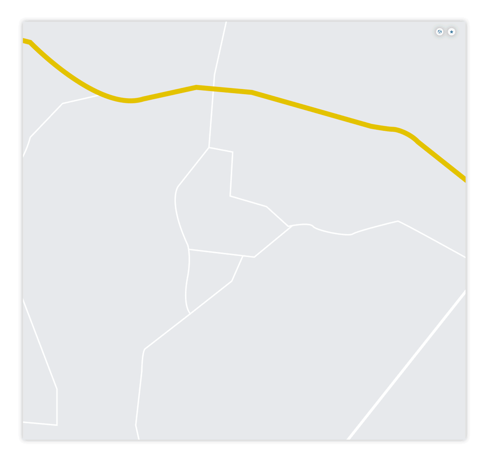

GIS mapping allows Jeanine to:
- clearly identify impacted land areas,
- overlay social and environmental data, and
- cross reference stakeholders with infrastructure assets.
Shapefiles in Borealis can be automatically imported and updated using the API to ensure consistency with other systems.
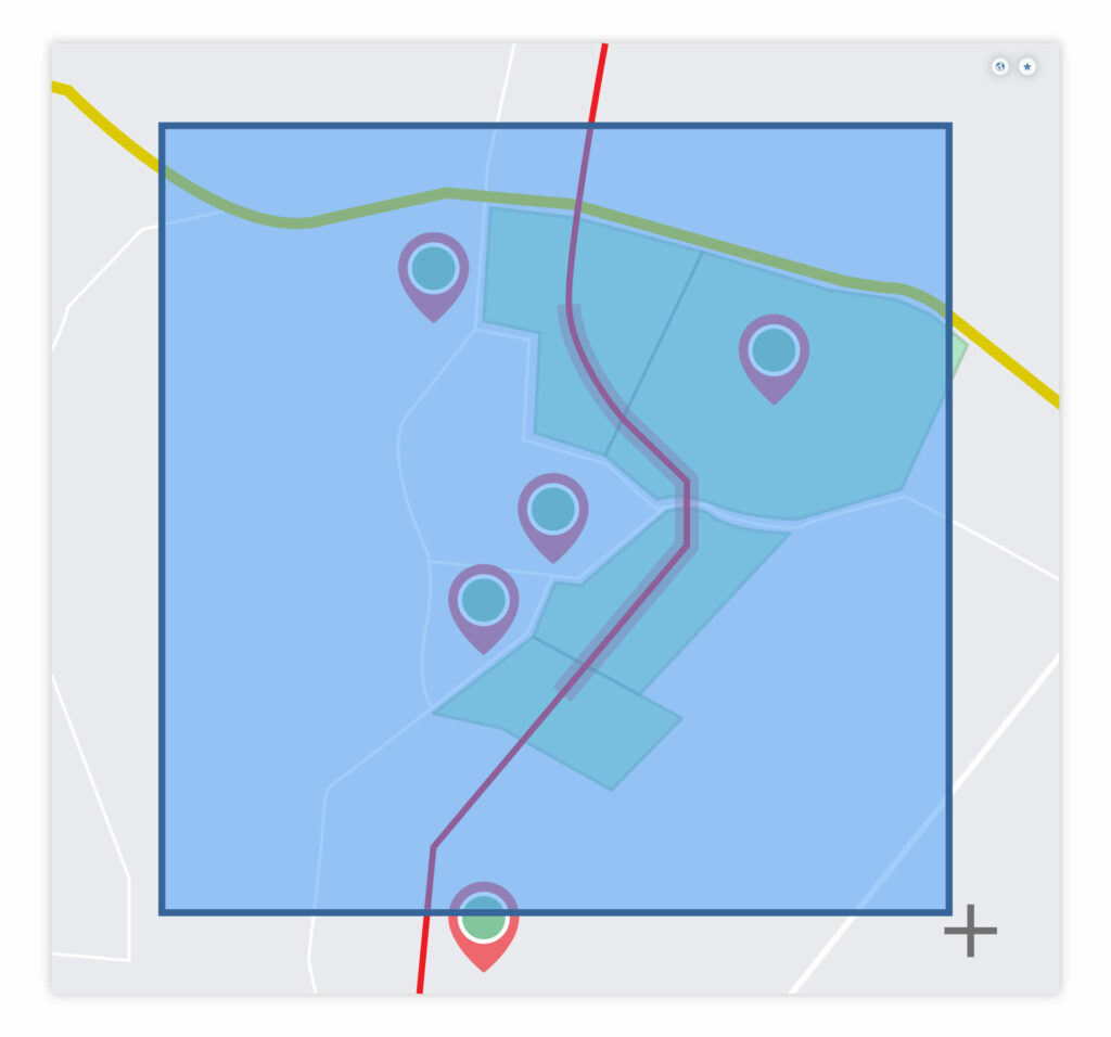
Borealis provides different options to help Jeanine build line list reports. She can:
- Draw points, lines, or polygons on the map to define a region.
- Copy and paste a list of coordinates (typically supplied by an engineering team) to generate a point, line, or polygon.
- Choose existing company assets (or specify the relevant chainage range of a linear asset) and define a buffer zone around the affected area
Plan and delegate engagement activities
Now that her line list is ready, Jeanine will start planning engagement activities. In Borealis, she can easily coordinate these efforts from her Stakeholder Engagement Plan.

Jeanine’s line list for this project includes more than 500 people. Some prefer to be contacted in person, while others want to be contacted by phone, email, or SMS.
Jeanine creates activities to contact stakeholders using their preferred method.
Next, she filters the line list and links stakeholders to the appropriate activity.
Finally, she enters a deadline (or frequency), and
assigns these activities to members of her team,
who will contact the stakeholders accordingly.
Create custom dashboards
to monitor activities in real time
To ensure that she always knows how the project is progressing, Jeanine configures her home page in Borealis to monitor important KPIs.
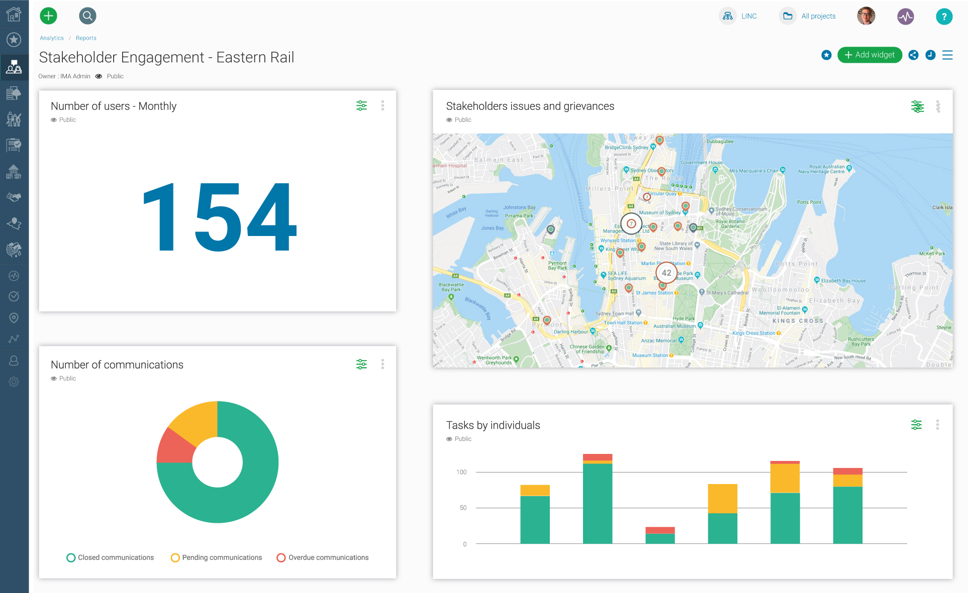
For this project she wants to make sure she always knows:
- how many stakeholders the team has interacted with,
- what topics have been discussed,
- who the key influencers are, and
- which engagement methods are used.
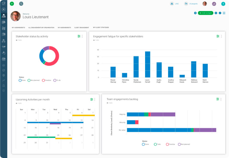
While Jeanine is primarily concerned with the bigger picture, members of her team need to focus on their personal assignments.
Jeanine creates personalized dashboards for her team that show:
- each person’s to-do list (tasks and activities),
- information about their key stakeholders, and
- a shared calendar, so everyone can see the schedule of upcoming engagements.
Use integrated communication tools
to document interactions
Rodrigo is a Community Relations Specialist on Jeanine’s team. He works in Borealis every day.
Rodrigo’s primary responsibility is reaching out to stakeholders to provide information, answer questions, and address any concerns that arise.
When Rodrigo interacts with a stakeholder he uses a number of time-saving tools to quickly document his interactions. His favorite features are the Outlook add-in – which lets him record emails and calendar events in Borealis without ever leaving Outlook – and the Borealis Mobile Application.
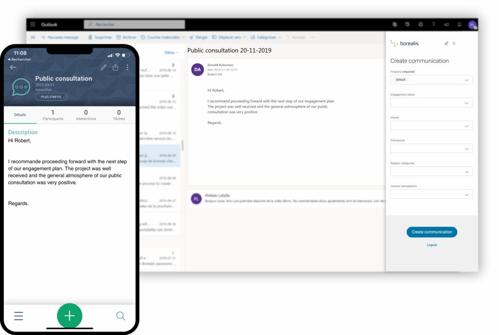
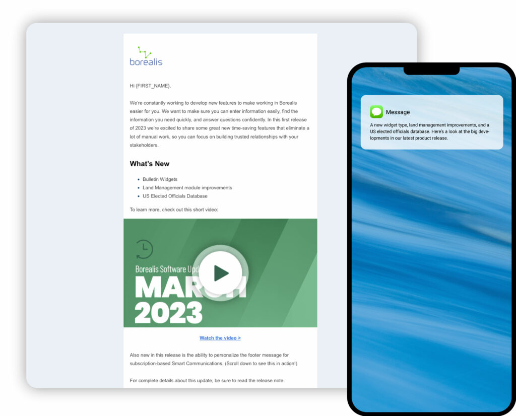
Rodrigo uses integrated communication tools like Smart Communications and the SMS messaging add-on allow him to send (and record) messages that are sent to groups of stakeholders, along with their replies.
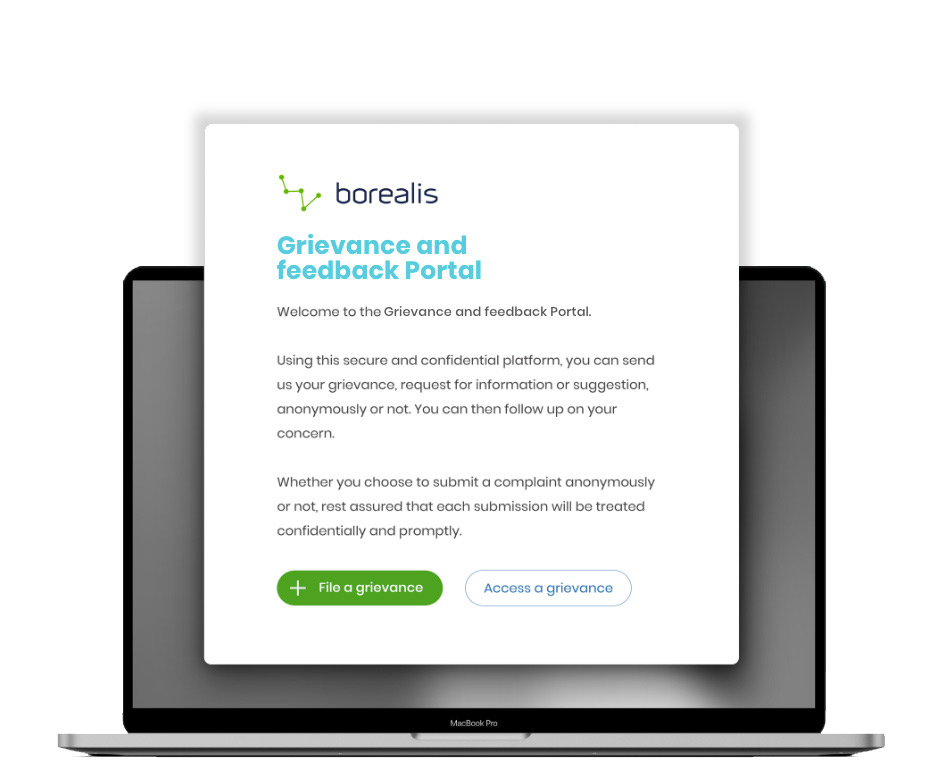
His team also uses the Online Grievance & Feedback Portal to collect anonymous feedback from stakeholders.
Rodrigo can review and respond to messages submitted through the portal right from Borealis.
Review recent interactions before reaching out
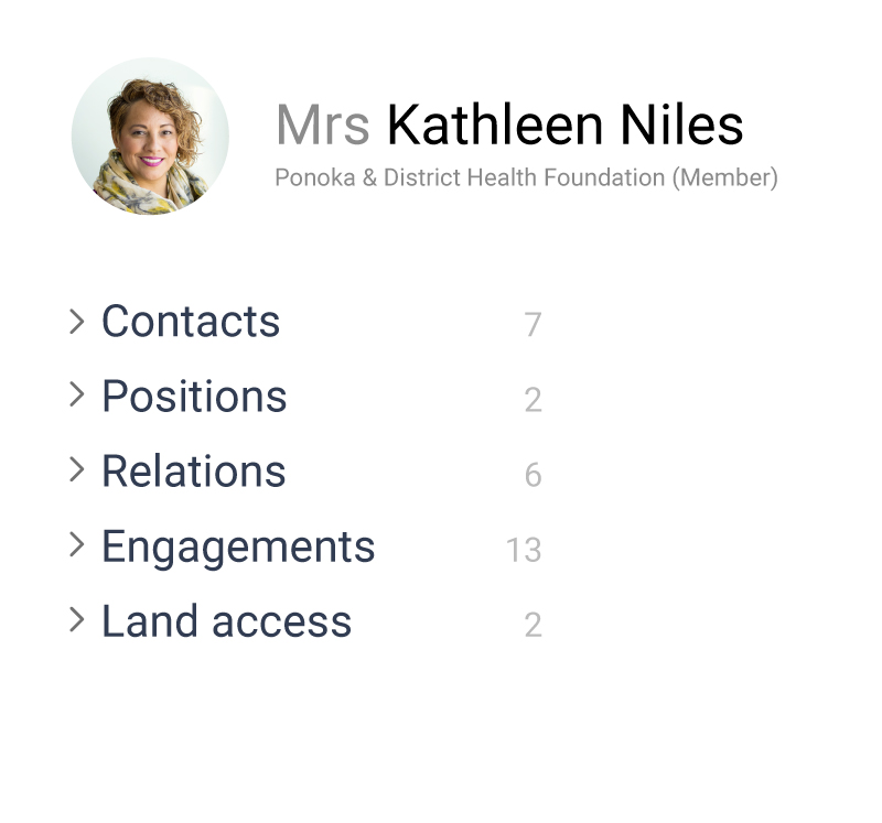
As a landowner, Kathleen might be contacted by other teams about other issues (such as inspections, compliance agreement, or right of way negotiations).
Before contacting Kathleen, Rodrigo checks the history of communications in Borealis to see if anyone else from his organization has interacted with her since their last conversation.
He reviews any recent communications to make sure he engages with her in an appropriate, informed way.

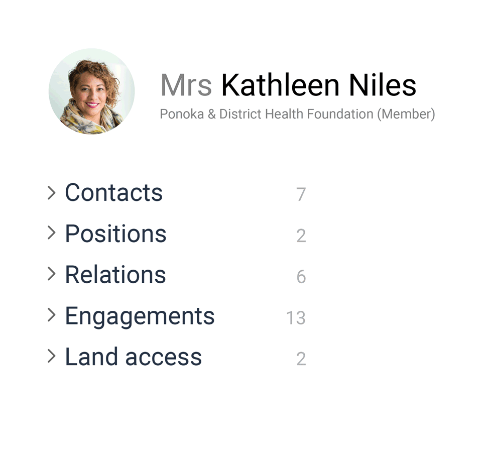
Rodrigo can see Kathleen’s land parcels on a map, together with information about the land itself and about any agreements that have been signed with her.
GIS overlaps let him see if her land parcels overlap other relevant areas, like county borders, protected areas, or electoral districts.
Any conditions for accessing the land and any agreements with the landowner can be linked to the land parcel itself for easy reference.
This lets teams monitor the complete history of engagements related to a specific parcel of land, including:
- interactions with a previous owner,
- prior commitments, and
- any complaints or grievances they should be aware of.
Attach documents and photos to records

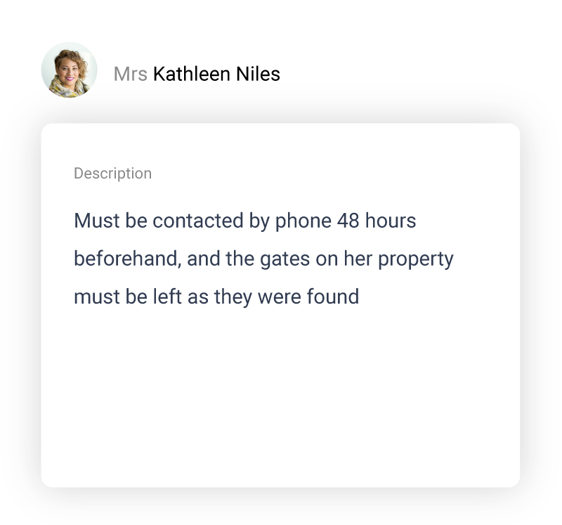
Users can easily add documents and photos to communications, land parcels, and stakeholder records. This makes it easy to demonstrate compliance when they need to provide evidence of consultation, or proof that landowners conditions were respected.
For example, when a maintenance team accesses Kathleen’s land, they can include a photo to prove that the gate was properly closed when they left the property.
The Borealis Mobile Application lets users access, create, and modify records to answer questions, enter communications or grievances, or add photos to a record.
The app includes an offline mode, which lets the team enter communications even when they don’t have a reliable internet connection, and the data will sync with Borealis the next time they connect to a network.
Users can also enter a location based on their phone’s GPS coordinates, which can be extremely helpful when referencing a specific position on a large land parcel.
Generate meaningful reports on demand,
in just a few clicks

Borealis Analytics lets Jeanine instantly generate reports to:
- inform strategic decisions,
- prioritize activities, and
- help her answer tough questions on the spot.
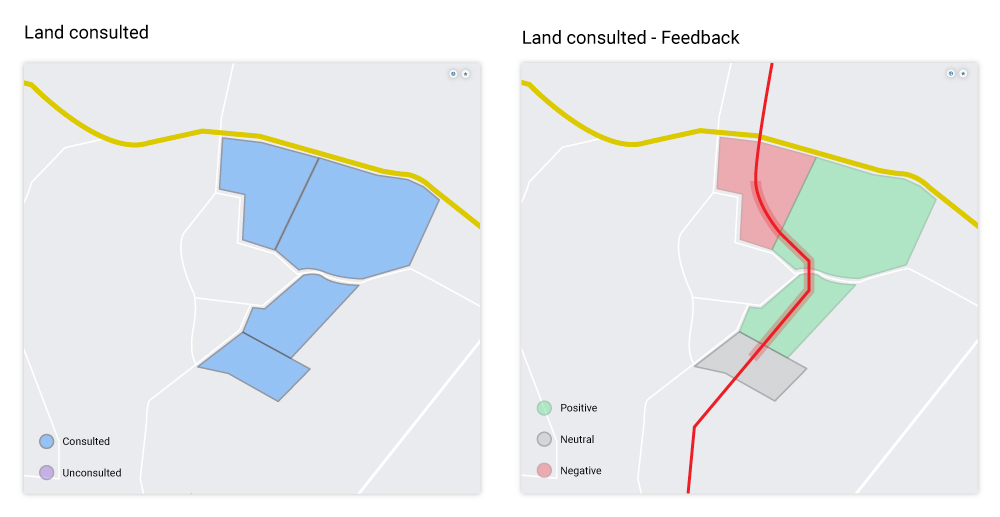
The Community Relations uses Analytics to:
- easily monitor areas where they have and haven’t engaged,
- track the status of easement or property tenure on the map, and
- gauge stakeholder sentiment to identify potential hot spots or concerns.
Congratulations!
Want to learn more?
MANAGING STAKEHOLDER ENGAGEMENT FOR LINEAR ASSET INTEGRITY PROJECTS
Before any sort of maintenance activity, teams need to contact different groups of stakeholders for a number of reasons. They might need to:
- negotiate right-of-way (ROW) agreements
- document landowners’ conditions for accessing land
- inform occupants about upcoming work and provide safety information
- ensure compliance with applicable laws
- secure regulatory approvals and acquire necessary permits
- arrange any necessary inspections
- coordinate with external suppliers and contractors
- document issues, concerns, or complaints
That’s a lot to manage! Fortunately, Borealis is designed to address these challenges
and support you every step of the way.
Let’s look at an example.
Before adopting Borealis, identifying the stakeholders for a project like this was a long and arduous task. Jeanine’s team had to comb through dozens of spreadsheets to assemble the list, then manually identify and manage duplicate records.
This time, Jeanine will use Borealis to quickly generate a line list report. She can identify stakeholders along the relevant section of pipeline in several ways.
Quickly identify the people you need to talk to
GIS mapping allows Jeanine to:
- clearly identify impacted land areas,
- overlay social and environmental data, and
- cross reference stakeholders with infrastructure assets.
Shapefiles in Borealis can be automatically imported and updated using the API to ensure consistency with other systems.
- Draw points, lines, or polygons on the map to define a region.
- Copy and paste a list of coordinates (typically supplied by an engineering team) to generate a point, line, or polygon.
- Choose existing company assets (or specify the relevant chainage range of a linear asset) and define a buffer zone around the affected area
Plan and delegate engagement activities
Now that her line list is ready, Jeanine will start planning engagement activities. In Borealis, she can easily coordinate these efforts from her Stakeholder Engagement Plan.
Jeanine’s line list for this project includes more than 500 people. Some prefer to be contacted in person, while others want to be contacted by phone, email, or SMS.
Jeanine creates activities to contact stakeholders using their preferred method.
Next, she filters the line list and links stakeholders to the appropriate activity.
Finally, she enters a deadline (or frequency), and assigns these activities to members of her team, who will contact the stakeholders accordingly.
Create custom dashboards to monitor activities in real time
To ensure that she always knows how the project is progressing, Jeanine configures her home page in Borealis to monitor important KPIs.
- how many stakeholders the team has interacted with,
- what topics have been discussed,
- who the key influencers are, and
- which engagement methods are used.
- each person’s to-do list (tasks and activities),
- information about their key stakeholders, and
- a shared calendar, so everyone can see the schedule of upcoming engagements.
Use integrated communication tools
to document interactions
Review recent interactions before reaching out
Rodrigo can see Kathleen’s land parcels on a map, together with information about the land itself and about any agreements that have been signed with her.
GIS overlaps let him see if her land parcels overlap other relevant areas, like county borders, protected areas, or electoral districts.
- interactions with a previous owner,
- prior commitments, and
- any complaints or grievances they should be aware of.
Attach documents and photos to records
Users can easily add documents and photos to communications, land parcels, and stakeholder records. This makes it easy to demonstrate compliance when they need to provide evidence of consultation, or proof that landowners conditions were respected.
For example, when a maintenance team accesses Kathleen’s land, they can include a photo to prove that the gate was properly closed when they left the property.
The Borealis Mobile Application lets users access, create, and modify records to answer questions, enter communications or grievances, or add photos to a record.
The app includes an offline mode, which lets the team enter communications even when they don’t have a reliable internet connection, and the data will sync with Borealis the next time they connect to a network.
Users can also enter a location based on their phone’s GPS coordinates, which can be extremely helpful when referencing a specific position on a large land parcel.
Generate meaningful reports on demand,
in just a few clicks
- inform strategic decisions,
- prioritize activities, and
- help her answer tough questions on the spot.
- easily monitor areas where they have and haven’t engaged,
- track the status of easement or property tenure on the map, and
- gauge stakeholder sentiment to identify potential hot spots or concerns.