


Don’t miss our Webinar on How to Operationalize Stakeholder Engagement in Energy and Infrastructure Projects.
Wednesday, April 13th. 11am (EDT)
There are many factors to consider when planning maintenance activities or the right path for a linear utility project. Having the right tools to assess, track, and understand these factors will directly impact the success, safety, and reliability of your project.
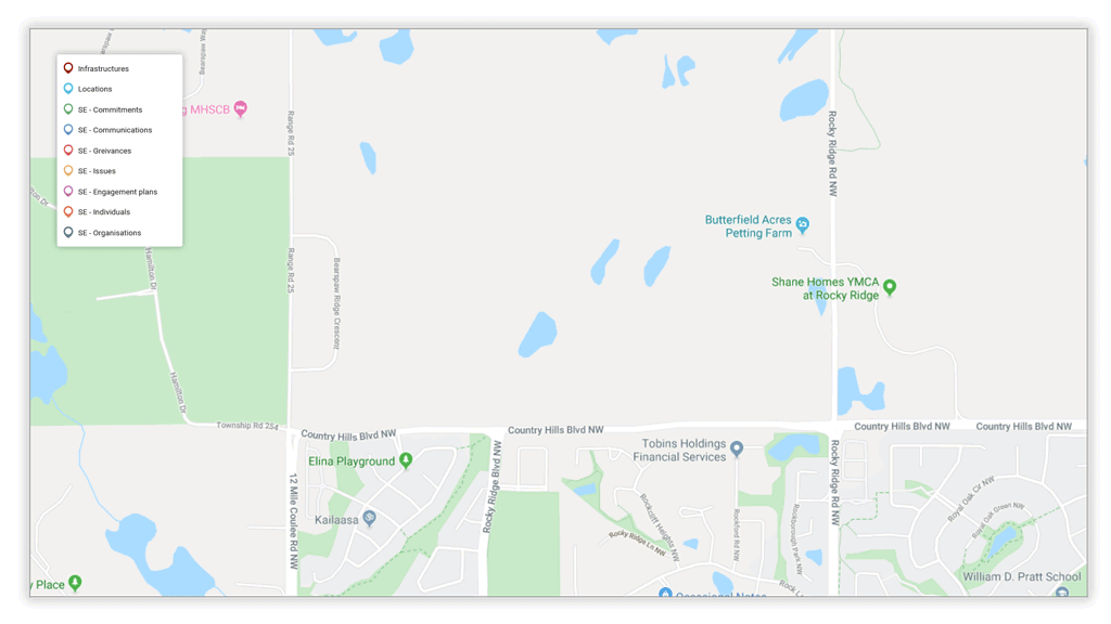
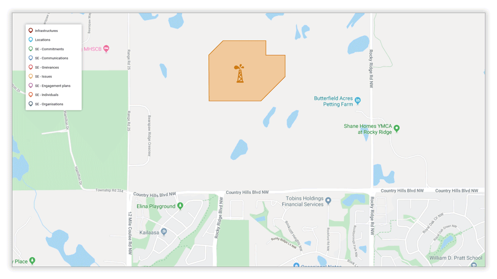
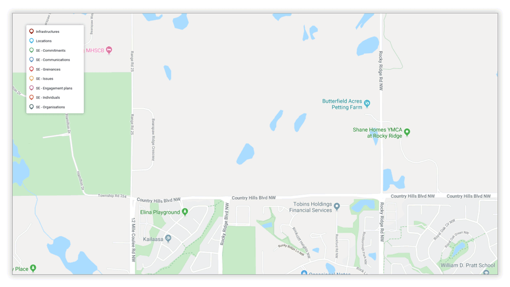
Automatically import and update various shapefiles in the system using Borealis’ API to obtain a clear view of impacted land areas, natural resources, assets, and infrastructure.
In land-based projects, stakeholders are often defined by land parcel and location within your project. Using geographical information technologies (GIS) and being able to link your commitments, communications, and engagements with these parcels is crucial. Plus, you’ll be sure no one is forgotten.

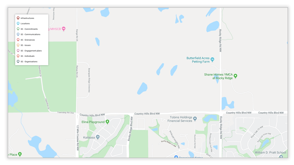
The buffer zone enables you to define an area around your assets to determine which parcel owners you need to talk to.
Merging maps and geographical information (like shapefiles) in Borealis will highlight which parcels are impacted by a route or other linear asset.
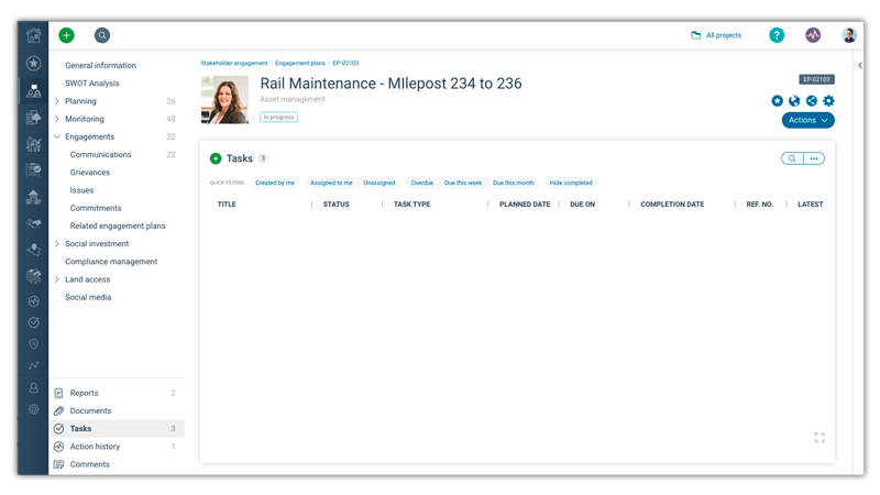

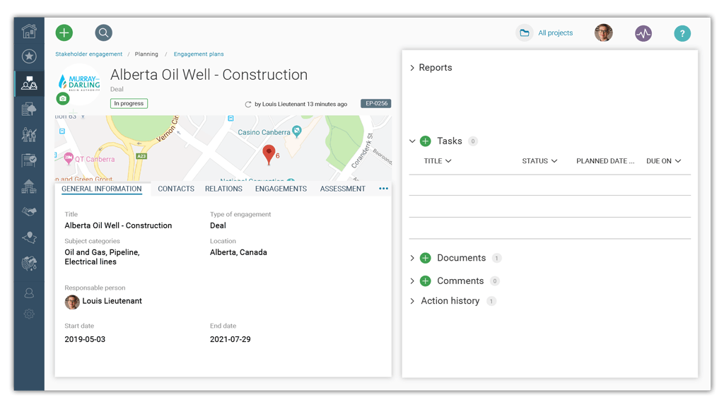
Be super efficient with Borealis project management functionalities. Create multiple engagement plans related to your objectives & milestones, preset all tasks, and assign them to your team.
You now have all the information you need to build a strong preliminary engagement plan. Keep in mind that projects change; so do stakeholders and their opinions. This plan will need to be reviewed and refined over time.
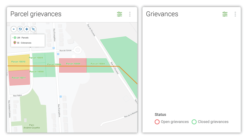
Borealis lets you follow the evolution of your engagement activities in real time, parcel by parcel.
Multiple data entry applications. User-friendly interface, mobile application, Outlook Add-In.
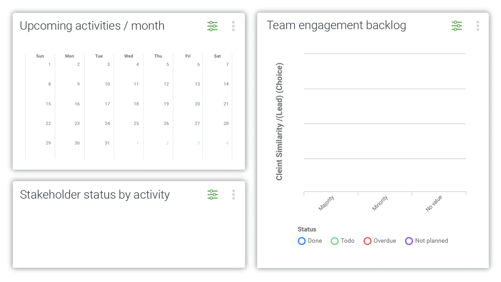
See if there are any hot spots or specific concerns that require more attention from your team.
Track data in real time and the history of your team’s engagements.
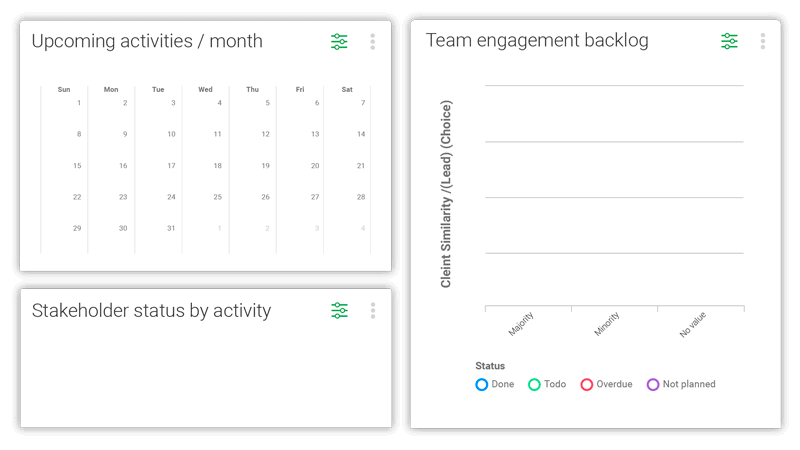
By this point, you will have a mountain of actionable data. Gain clear insight in no time on how quickly you’re advancing toward project approval. Our Analytics modules allow you to:
Demonstrate compliance
Easily prove compliance with industry regulations and investor requirements by extracting information showing who you have been communicating with, and when.
After you have analyzed your data, you’ll be able to plan strategic actions that take into account both your operations and your stakeholders. This will ensure smoother and quicker approval for your project, avoiding wasted funds.

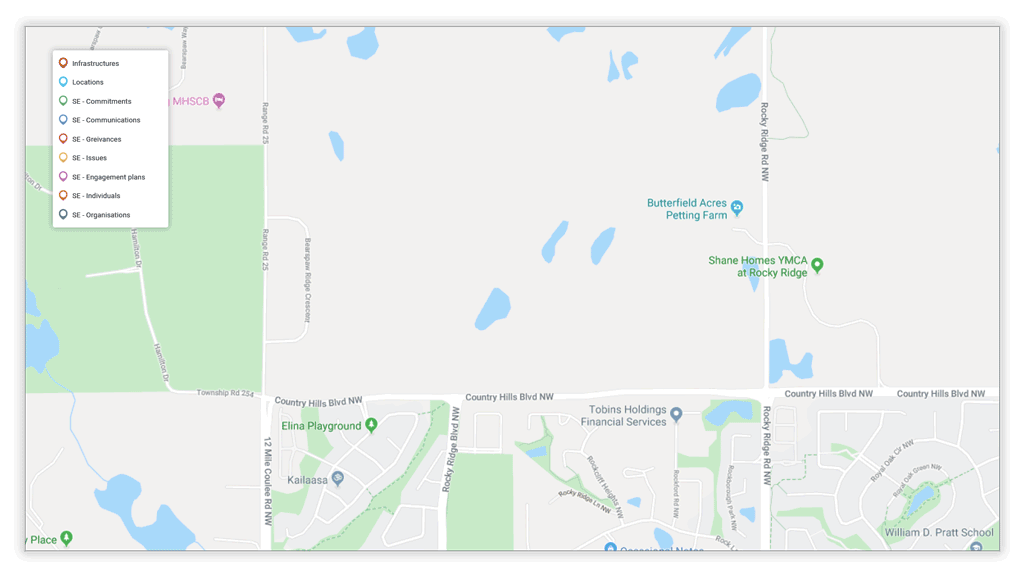
Drilling down
directly from your map lets you access the right information intuitively in a fraction of the time.
Mapping assets and stakeholders
Mobile
application
Buffer
zone
Multiple options for entering data
Analytics
As part of our service, a member of our customer success team will visit your business to understand your internal methodologies, day-to-day challenges and stakeholders. We take the time to find out how we can ease system adoption and optimize the way you build relationships with stakeholders. Get a confident start now.
There are many factors to consider when planning maintenance activities or the right path for a linear utility project. Having the right tools to assess, track, and understand these factors will directly impact the success, safety, and reliability of your project.
Borealis Assets and Land Management functionality
Automatically import and update various shapefiles in the system using Borealis’ API to obtain a clear view of impacted land areas, natural resources, assets, and infrastructure
In land-based projects, stakeholders are often defined by land parcel and location within your project. Using geographical information technologies (GIS) and being able to link your commitments, communications, and engagements to these parcels is crucial. Plus, you’ll be sure no one is forgotten
The buffer zone enables you to define an area around your assets to determine which parcel owners you need to talk to.
Merging maps and geographical information (like shapefiles) in Borealis will highlight which parcels are impacted by a route or other linear asset.
You now have all the information you need to build a strong preliminary engagement plan. Keep in mind that projects change; so do stakeholders and their opinions. This plan will need to be reviewed and refined over time.
Be super efficient with Borealis project management functionalities. Create multiple engagement plans related to your objectives & milestones, preset all tasks, and assign them to your team.
Borealis lets you follow the evolution of your engagement activities in real time, parcel by parcel.
Multiple data entry applications. User-friendly interface, mobile application, Outlook Add-In.
By this point, you will have a mountain of actionable data. Gain clear insight in no time on how quickly you’re advancing toward project approval. Our Analytics modules allow you to:
Demonstrate compliance
Easily prove compliance with industry regulations and investor requirements by extracting information showing who you have been communicating with, and when.
See if there are any hot spots or specific concerns that require more attention from your team.
Track data in real time and the history of your team’s engagements.
After you have analyzed your data, you’ll be able to plan strategic actions that take into account both your operations and your stakeholders. This will ensure smoother and quicker approval for your project, avoiding wasted funds.
Drilling down
directly from your map lets you access the right information intuitively in a fraction of the time.
Once your project is approved and ready to move forward, continue to maintain positive relationships with stakeholders. Chances are you’ll need to re-engage them as things evolve, and their continued support will be essential. Stay on top of your compensation commitments using Borealis’ land access functionality.
As part of our service, a member of our customer success team will visit your business to understand your internal methodologies, day-to-day challenges and stakeholders. We take the time to find out how we can ease system adoption and optimize the way you build relationships with stakeholders. Get a confident start now.